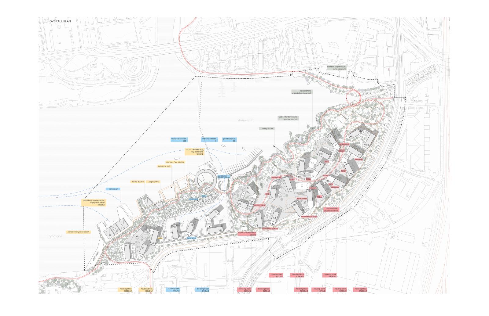
Human settlements in the past were usually formed around sources of energy, food, or water, and these sources became the activators of a whole network of interconnected everyday life situations and activities of our present day cities. For the new Viinikanlahti city district we suggest a series of strategic master plan interventions that would act as such spatial catalysts on a smaller scale - by gradually activating the spaces between and around them, they would eventually lead to the transition of the proposed site from agricultural and contaminated industrial land in the past, towards the new high-quality housing, recreational and leisure environment in the future.
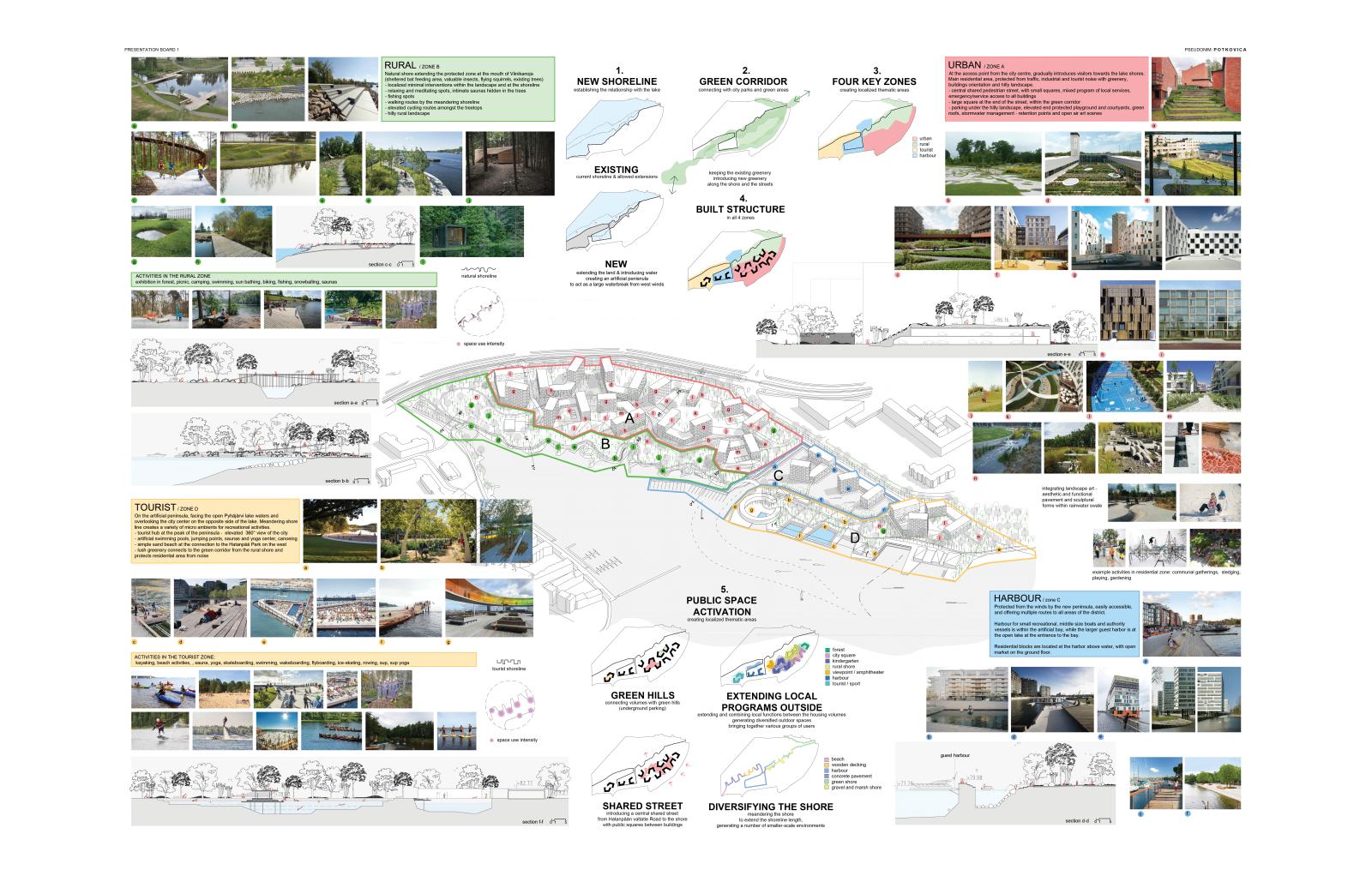
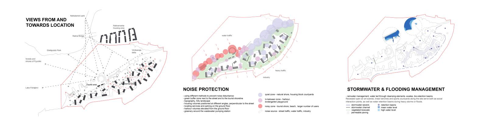
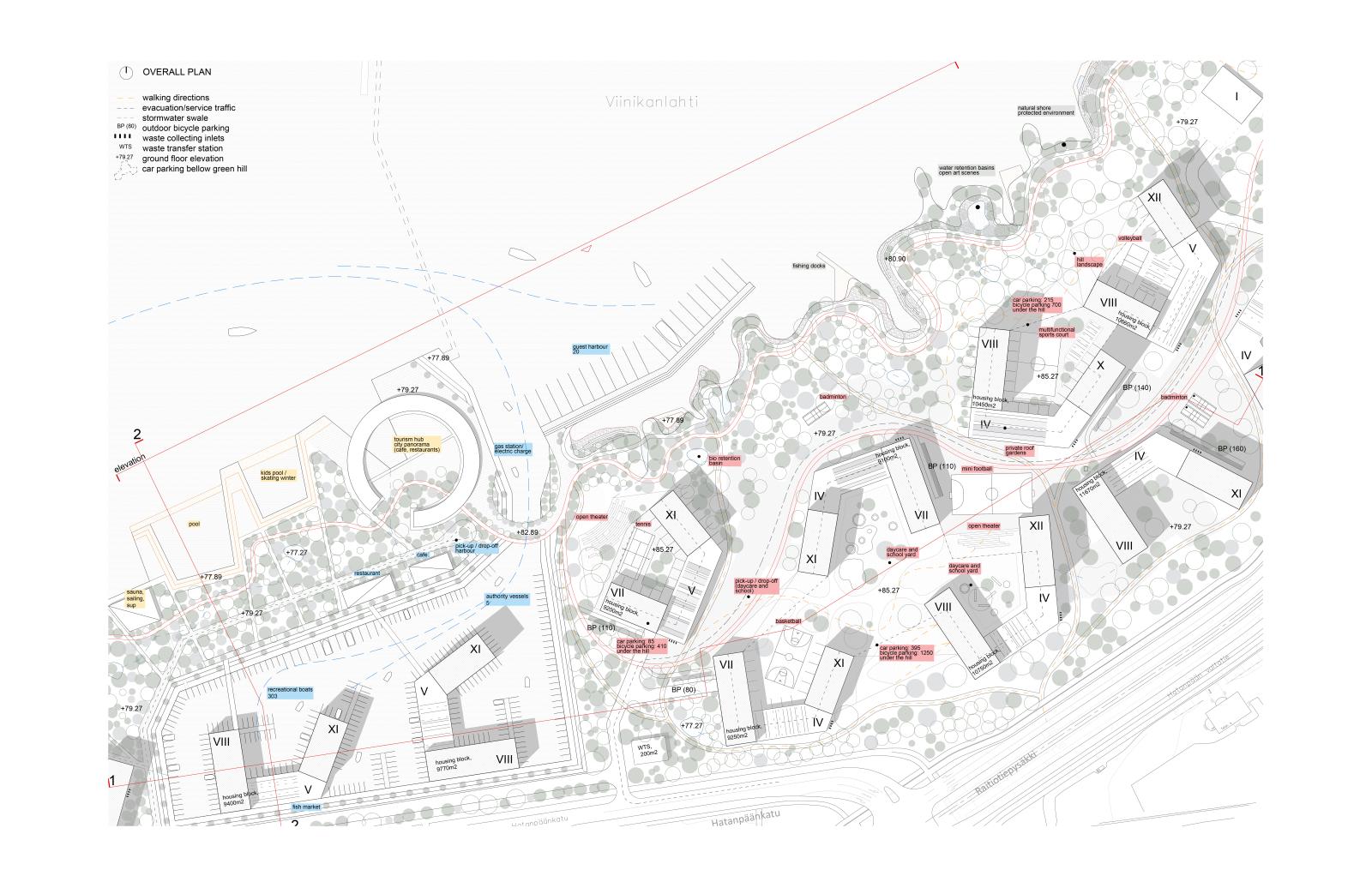
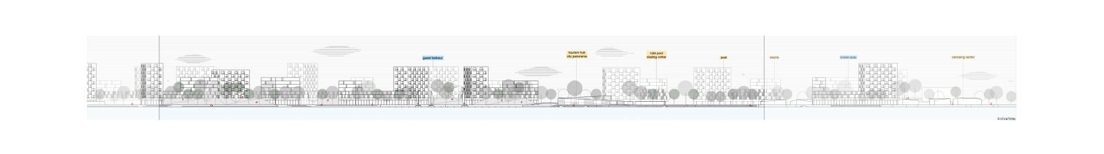
We modify the existing shoreline of the Pyhäjärvi lake to introduce water into the site, this way establishing a strong relationship with the lake, and creating a protected and easily accessible space for the harbor. At the same time, this ensures that the shorelines are free from boats and open for developing a variety of recreational and leisure activities. A continuous tree-covered corridor is established throughout the location, along the shore and the Hatanpään valtatie Road, by preserving existing trees and planting new ones. This way, the site is connected to the city parks in Hatanpää and Lake Iidesjärvi, as well as protected from traffic, industrial and tourist noise. The introduction of the harbor into the heart of the site establishes four key zones: urban, rural, tourist and harbor.
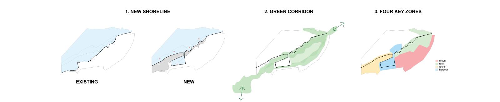
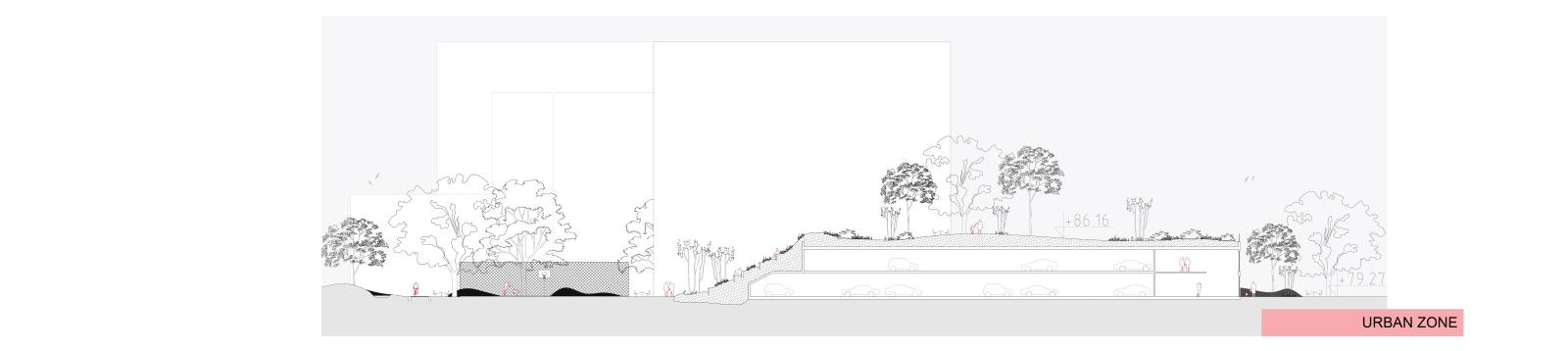
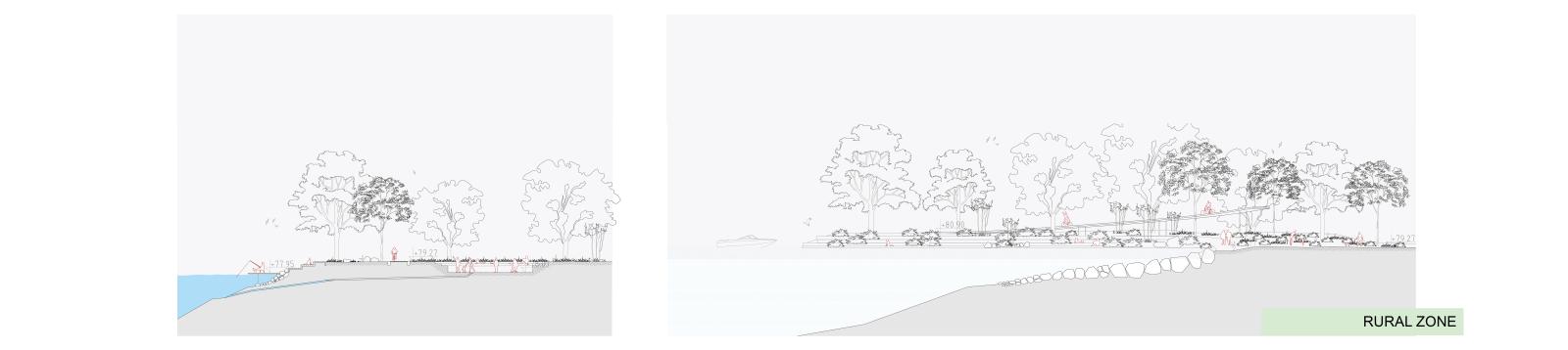
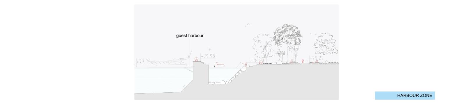
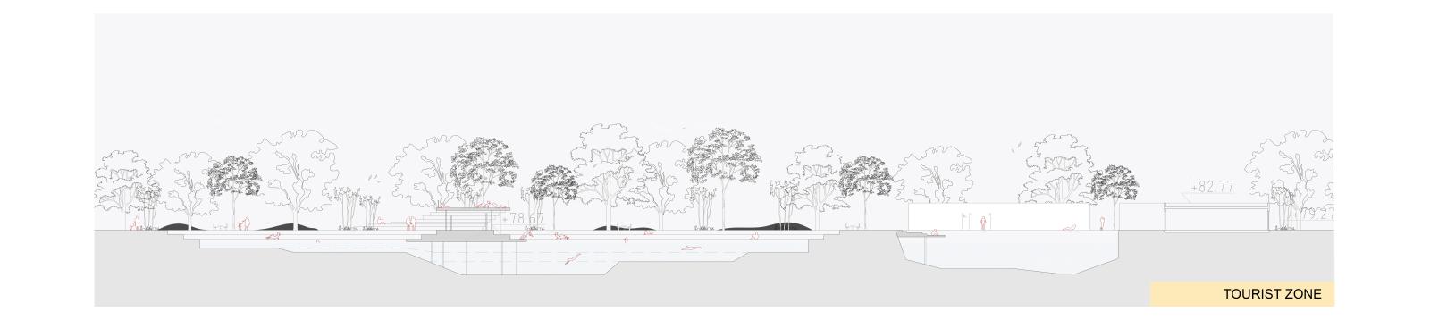
Urban zone is the area first encountered when driving from the city centre. With its central shared pedestrian street between the housing blocks, it gradually introduces the visitors from the city to the lake shores. Rural shore is on the east and extends the protected environment of the mouth of Viinikanoja. This is lushly planted and quiet area, with minimal local interventions – spots for meditating, small saunas in the forest, fishing docks, sports courts in the shade of the trees, and natural sand and gravel beaches. Tourist shore on the artificial peninsula is facing the open Pyhäjärvi lake waters and overlooking the city centre on the opposite side of the lake. Leisure and recreational activities, are all located at the very edge between land and water, and protected with a tree-covered area from the harbor in the south. The flow of the Tammerkoski Rapids ensures that the tourist shore wouldn’t freeze during winter, allowing for recreational activities all year long. The Harbor is protected from west winds by the new peninsula, easily accessible and offers multiple routes to all areas of the district. It is connected with the lake via the harbor entrance and smaller water channels, so that the water inside the artificial bay always remains fresh and clean.
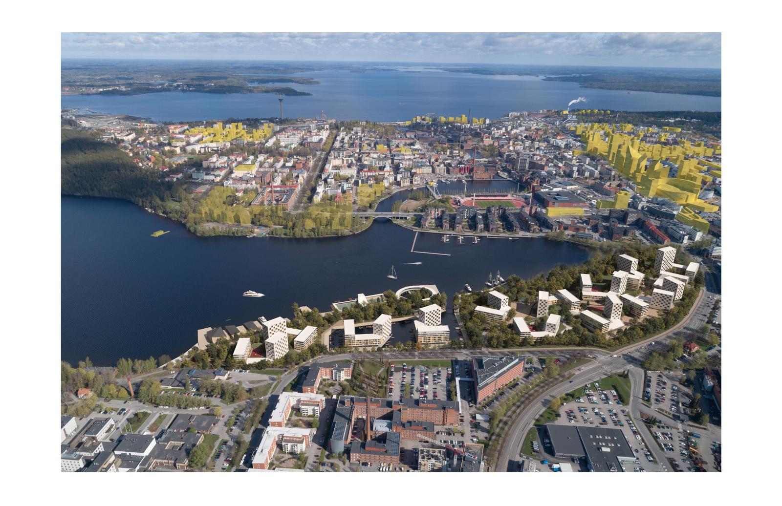
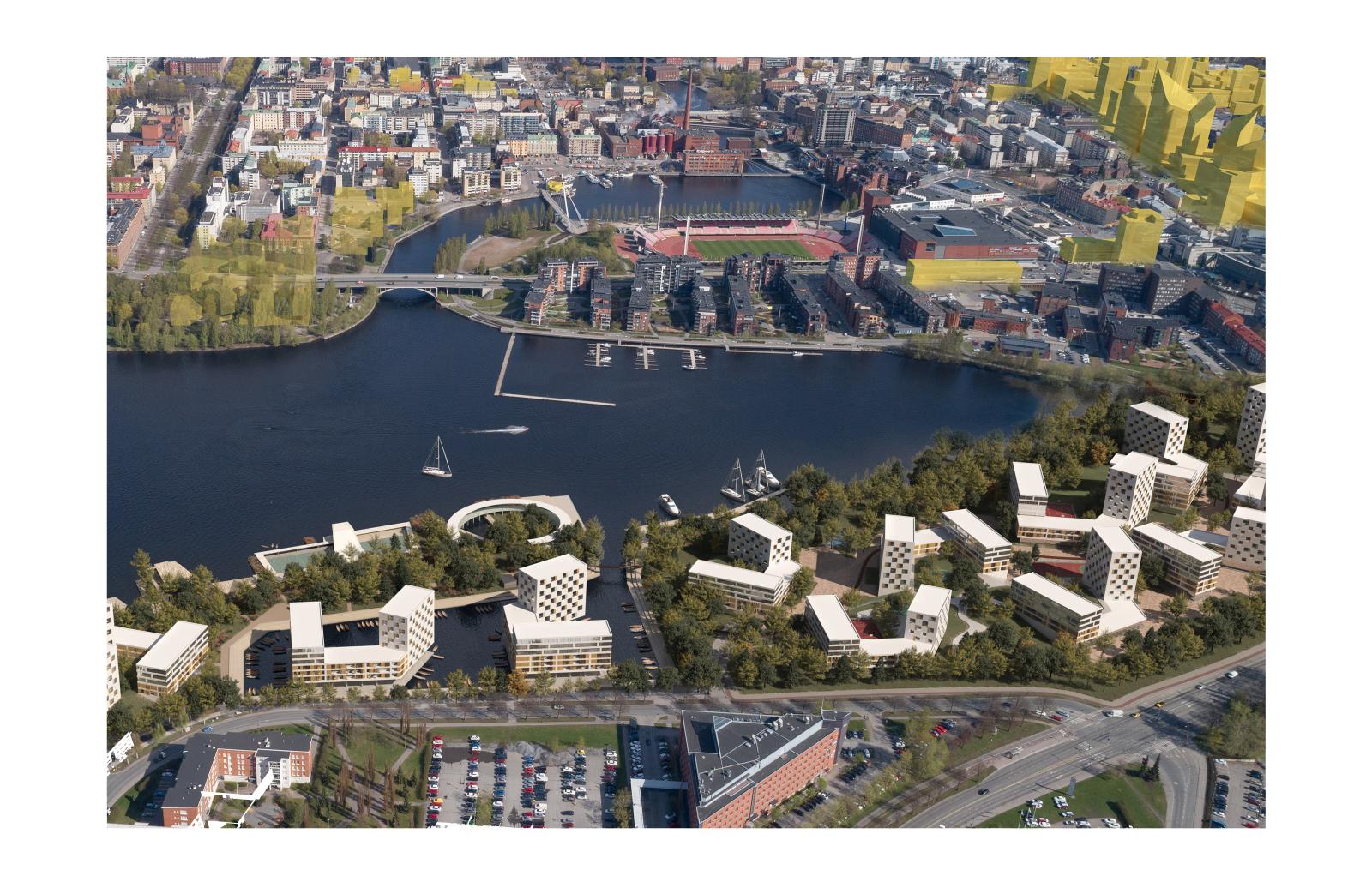

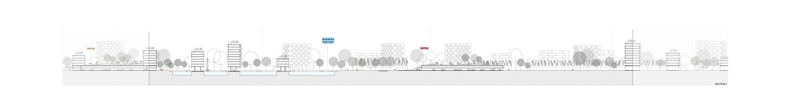
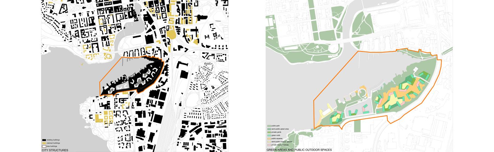
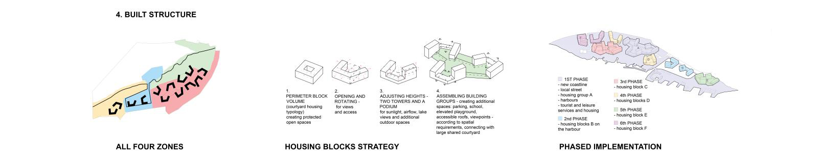
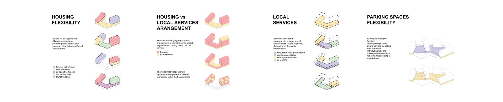
We introduce a system of housing blocks within all four zones of the site. Each block consists of two towers of varying heights and one lower podium that connects them, this way creating a small semi-open protected courtyard. The blocks are oriented to ensure lake views for most of the apartments, maximum sunlight, and minimum noise exposure. They are organized to support phased implementation, starting from the new coastline, kindergarten and harbor blocks, and ending with the blocks that are located further away from the shore. Smaller structures are built along the tourist shore, and are merged within lushly planted landscape, so that only the towers are visible from afar, and form the new city skyline.
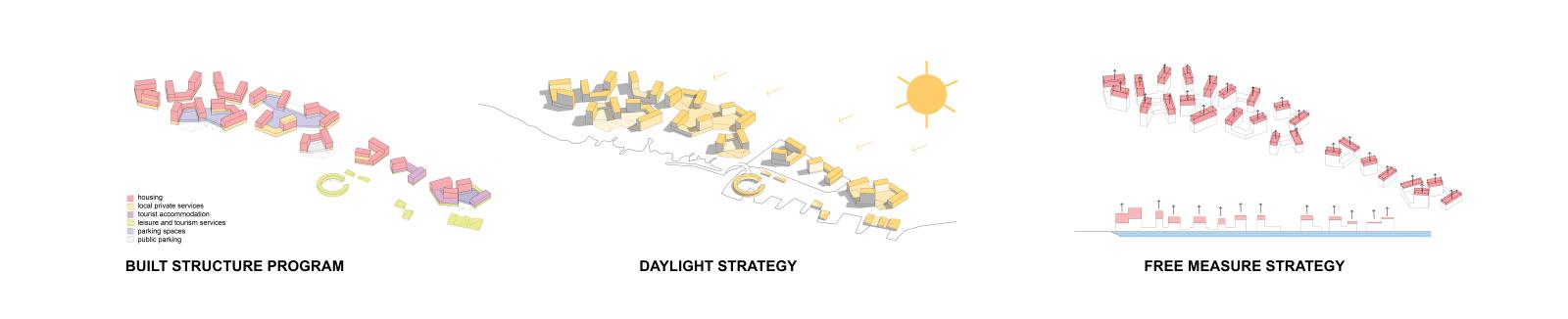
The centralized harbor, new housing blocks and tourist and rural shores all serve as macro event initiators within the site. Each housing block also offers specific public programs, so that it locally activates the open space around it. Individual programs mutually overlap and create thematically diversified outdoor spaces. The lake shore is meandering to allow for a variety of micro ambients within the landscape. Shoreline gradually transitions from rural environment at the mouth of Viinikanoja to the urbanized tourist shore at the peninsula, ending in an intimate sand beach that establishes a fragile link between the new Viinikanlahti city district and the Hatanpää park in the west.
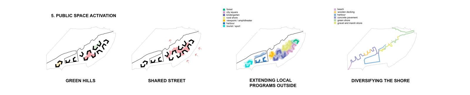
Recessed open air art scenes and linear benches along the site serve both as social interaction points, as well as water retention basins during heavy storms or floods. Housing blocks are connected with green hills covering underground car parking, offering protected elevated green courtyards that overlook the lake and the landscape. The peninsula would partially direct the water from the rapids to the east side of the lake, initiating water circulation and cleaning the lake water at the the mouth of Viinikanoja.